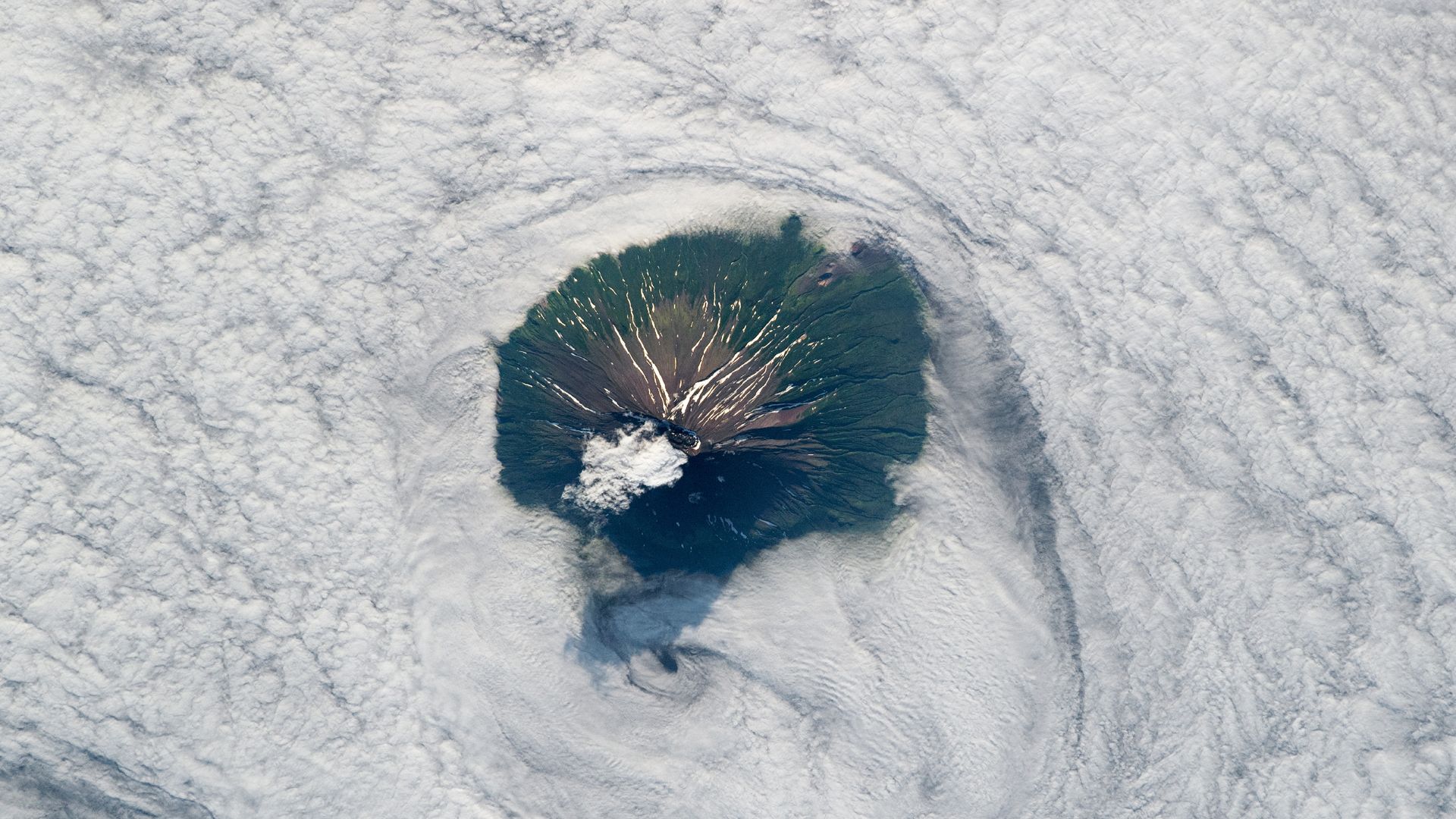
An unnamed astronaut aboard the International Space Station photographed Alaid volcano on August 2, 2019, as its summit poked above thick clouds off Russia's Kamchatka Peninsula. The volcano sits on Atlasov Island, the northernmost of the Kuril Islands, a chain of roughly 50 largely uninhabited volcanic landmasses stretching along a fault line between Russia and Japan in the Sea of Okhotsk.
Alaid reaches 7,497 feet (2,285 meters) above sea level, making it the tallest peak in the Kuril Islands. The volcano is known for its near-perfect cone shape. According to the Smithsonian Institution's Global Volcanism Program, Alaid has erupted at least nine times in the past 50 years. A major 1981 eruption ejected a 1,250-mile-long (2,000 km) plume of smoke and ash into the atmosphere. The volcano's most recent eruption occurred between September and November 2022, when lava flowed down its flank.
In the astronaut's photo, roughly half of Atlasov Island rises above a deep bank of swirling clouds. The summit is obscured by clouds topped by a roughly mile-wide caldera. Snow-filled gullies carved by previous lava flows appear farther down the volcano's flanks. Parasitic cones, small openings where lava burst through previously, are visible around the cloud layer's edge, according to NASA's Earth Observatory.
The area surrounding parasitic cones on the volcano's northwest flank shows no vegetation as a result of a 1972 eruption that scoured the landscape with hot ash. A 2009 study noted that recovery is occurring but could take hundreds of years for vegetation to return to pre-eruption levels.
Alaid represents the exposed summit of a much larger underwater volcano beneath the Sea of Okhotsk. Lava flows that reached sea level and solidified created the island around the cone. Millions of years ago, this larger volcano was likely connected to the Kamchatka Peninsula via a land bridge that has since been submerged.