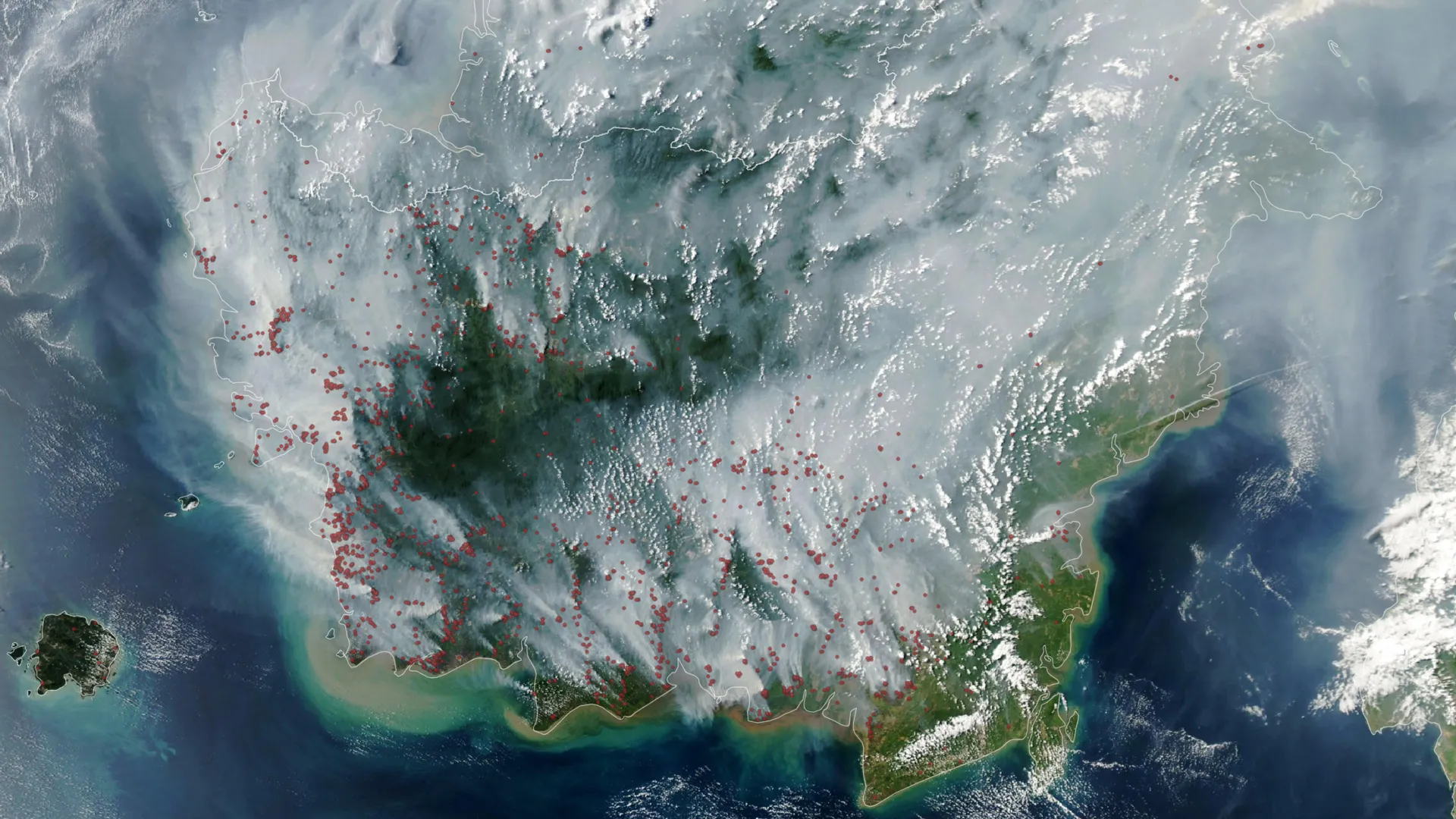
Indonesia faces a mounting crisis as peat fires ignite earlier and more intensely than usual in 2026, driven by strengthening El Niño conditions and severe drought. These underground blazes pose a distinct threat compared to conventional forest fires, releasing substantially higher volumes of harmful pollutants and particulate matter while evading satellite detection.
Peat fires burn differently than surface forest fires. Peat consists of partially decomposed organic material accumulated in wetlands over thousands of years. When these saturated soils dry out, they become combustible. Unlike surface fires that consume vegetation above ground, peat fires smolder underground, moving through organic layers and persisting for months even without visible flames. A single peat fire can burn across vast areas beneath the surface, making containment and monitoring exceptionally difficult.
The pollution signature of peat burning sets these fires apart. When peat smolders, it releases disproportionately high concentrations of fine particulate matter, or PM2.5, along with carbon monoxide, volatile organic compounds, and other air pollutants. These particles penetrate deep into human lungs and bloodstream, causing respiratory and cardiovascular damage. A peat fire smaller in area than a typical forest fire can generate comparable or greater air pollution impacts across Indonesia and neighboring countries like Malaysia and Singapore.
The 2026 season's early intensity stems from converging climate factors. El Niño, the periodic warming pattern of the equatorial Pacific Ocean, reduces rainfall across Indonesia. The current strengthening episode coincides with a broader regional drought, desiccating peatlands that normally remain waterlogged. Wetland water tables drop below the peat surface, exposing fuel to fire. Climate records show Indonesia experienced severe peat fire seasons in 1997 and 2015 during strong El Niño years, with 2015 producing hazardous air quality across Southeast Asia.
Satellite detection represents another complication. Thick smoke from smoldering peat obscures thermal signatures that satellites typically use to identify fires. Ground-level monitoring becomes essential but remains inadequate across Indonesia's vast landscape. Fire detection delays response time and complicate efforts to estimate fire extent and emissions.
Indonesia's peatlands store approximately 36 billion tons of carbon. When peat burns, this ancient carbon releases into the atmosphere, contributing substantially to greenhouse gas emissions. The 1997 El Niño season generated emissions equivalent to 13 to 40 percent of global annual fossil fuel emissions from peat fires alone, according to various research estimates.
Prevention depends on maintaining peatland water levels. Drainage for agriculture, palm oil plantations, and development has lowered water tables across millions of hectares. Wetland restoration and fire prevention efforts target re-wetting peatlands, but implementation remains patchy and underfunded. Early warning systems using ground sensors and improved satellite technology offer promise but require investment.
The 2026 season serves as a test case for Indonesia's fire management infrastructure. If peat fire impacts worsen as conditions strengthen, regional air quality emergencies and global carbon release will escalate. Long-term solutions require protecting remaining peatlands from drainage while restoring hydrological conditions in degraded wetlands.