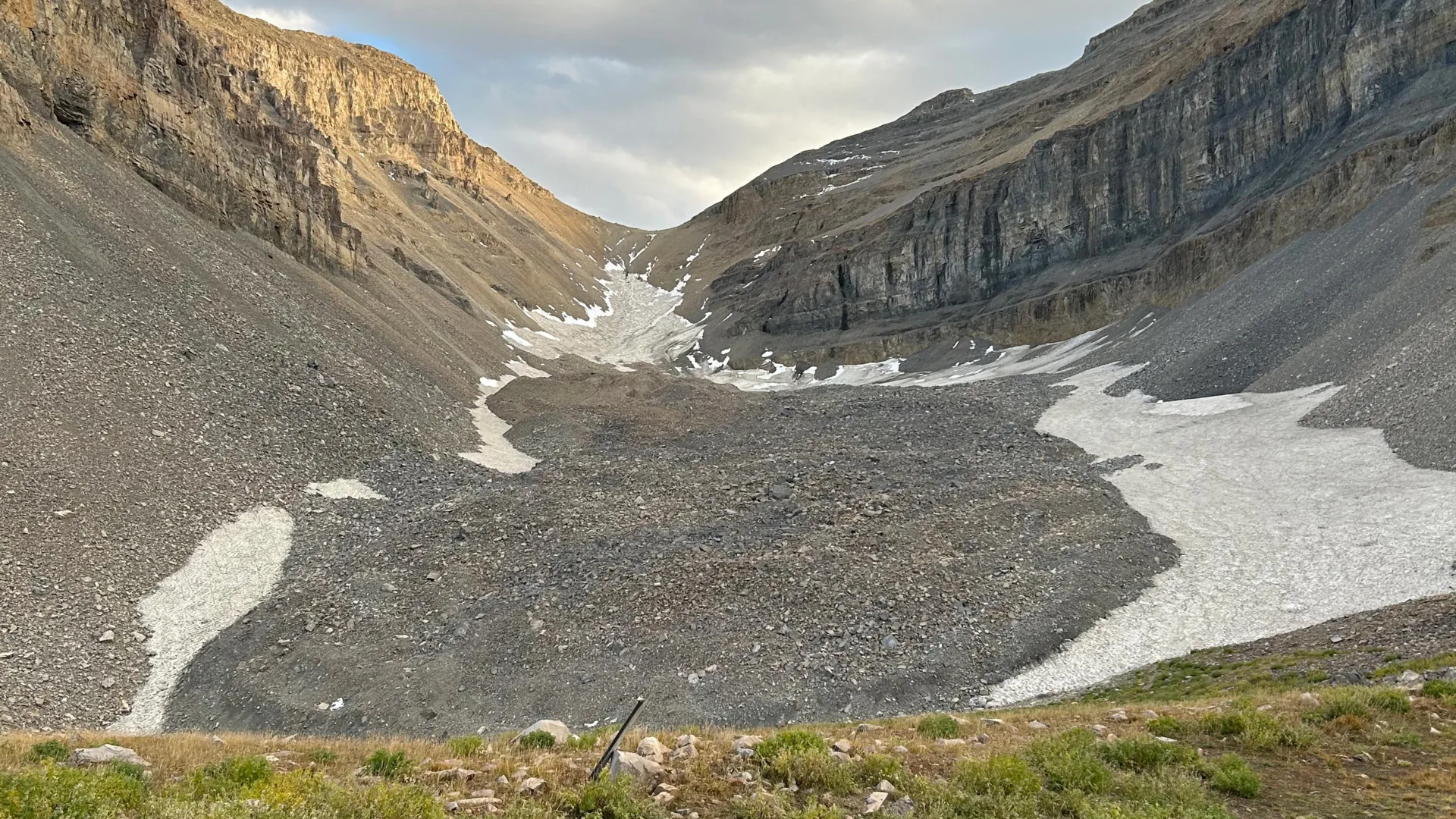
Researchers have discovered a massive underground ice reservoir hidden beneath Mount Timpanogos in Utah's Wasatch Range, revealing far more frozen water than surface observations suggested. The team used gravity measurements to create detailed three-dimensional maps of the buried glacier and determined it contains approximately 83% ice, with enough volume to fill roughly 600 Olympic swimming pools.
The discovery centers on what geologists call a rock glacier. These formations develop when falling debris and rocky material gradually bury persistent snow and ice, creating a protective layer that preserves the frozen water for millennia. The researchers' work demonstrates that rock glaciers function as substantial water reservoirs that remain hidden from conventional surveys that rely on visual inspection alone.
The gravity-based mapping technique proved essential to understanding the subsurface structure. By measuring subtle variations in Earth's gravitational field across the mountain, scientists could infer the density and distribution of materials beneath the surface. Ice, being denser than air-filled rock but less dense than solid stone, creates distinctive gravity signatures that reveal its location and volume. This method allowed the team to peer through the overlying rock and debris that masks the ice from direct observation.
The implications extend far beyond a single Utah mountain. The researchers note that rock glaciers similar to Mount Timpanogos's formation exist throughout mountainous regions globally. If these formations collectively store tens of gigatons of water, as the study suggests, they represent a previously underestimated component of Earth's freshwater reserves. A gigaton equals one billion metric tons, meaning the worldwide total could reach billions of metric tons of hidden ice.
Rock glaciers occupy a unique ecological niche in the cryosphere, the Earth's system of frozen water. Unlike traditional glaciers that flow visibly across terrain, rock glaciers move slowly beneath their rocky armor, sometimes advancing only a few meters per year. Their hidden nature means they have received less attention from climate scientists monitoring ice loss. Yet as global temperatures rise, these formations may contribute to water budgets in ways previously unrecognized.
The research raises practical questions about water availability in mountain regions. Many areas dependent on seasonal melt from glaciers and snowpack rely on these water sources for agriculture, drinking water, and hydroelectric generation. The discovery that substantial ice reserves exist in rock glaciers suggests communities may have more accessible freshwater than previously understood, though the rate at which this ice melts remains uncertain.
The timing of this discovery coincides with increasing scrutiny of how climate change affects mountain water supplies worldwide. Rock glaciers respond to temperature changes, though typically more slowly than surface glaciers. Understanding their full extent and behavior becomes important for predicting future water availability in arid and semi-arid regions where mountain snowmelt drives entire regional water cycles.
The methodology employed here opens new possibilities for ice reconnaissance globally. Gravity surveys can be conducted by aircraft or satellites, making them feasible for mapping rock glaciers across remote mountain ranges where direct access remains difficult. Future surveys using this technique could reveal whether other major mountain systems harbor similarly substantial hidden ice reserves.