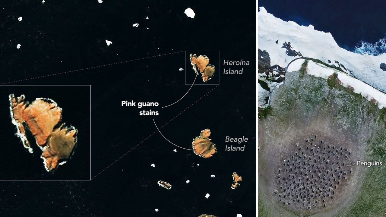
Researchers have used NASA satellite imagery combined with ground observations to monitor dietary shifts in penguin populations on Antarctica's Danger Islands. The work tracks changes in what these birds eat by analyzing their guano, or droppings, visible from space.
Penguin waste contains pigments from their food sources, primarily krill and fish. When large penguin colonies defecate into the ocean, the resulting staining creates visible patterns that satellites can detect. NASA's imaging technology captures these color signatures, allowing scientists to infer what penguins consumed without direct observation of each bird.
This remote sensing approach offers researchers a non-invasive way to assess penguin health and food availability across vast Antarctic regions. The Danger Islands, located off the Antarctic Peninsula, host significant penguin populations that serve as indicators of broader ecosystem health in the Southern Ocean. By tracking dietary composition over time, scientists gain insight into how ocean conditions affect prey availability and how penguins respond to environmental changes.
The study combines satellite data with fieldwork, grounding the remote observations in verified biological knowledge. Ground teams confirm what satellite data reveals, validating the technique's reliability. This dual approach strengthens conclusions about penguin populations and ocean food webs.
Understanding penguin diets matters for conservation. These seabirds are sensitive to ocean temperature fluctuations, fishing pressure, and prey availability. Changes in their feeding patterns can signal broader shifts in Antarctic marine ecosystems. As climate change alters ocean conditions, monitoring what penguins eat provides early warning of ecological disruption.
The research demonstrates how space-based tools extend scientific capacity in remote, harsh environments where traditional field surveys face logistical challenges. Satellite imagery eliminates the need for researchers to physically approach every colony, reducing disturbance to nesting birds while covering larger areas more efficiently. This technological integration between orbital data and ground truth establishes a scalable model for wildlife monitoring across Antarctica and potentially other