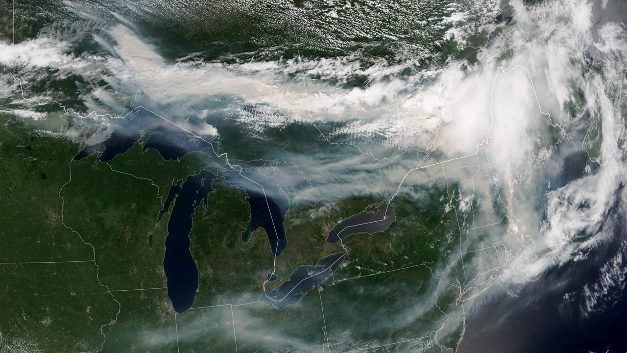
Satellites orbiting Earth have captured striking images of smoke plumes from devastating wildfires across Canada, visible from space on July 17, 2026. The photographs document the scale and atmospheric reach of the fires, showing massive columns of smoke extending far beyond the burning regions.
Space-based imagery provides critical data for tracking wildfire behavior and smoke dispersal across continents. Satellites equipped with advanced imaging sensors detect thermal signatures from active fires and monitor aerosol concentrations in the atmosphere. This real-time information helps emergency responders coordinate firefighting efforts and allows air quality agencies to issue health warnings for affected populations downwind.
The visibility of the smoke from orbital altitude underscores the intensity and extent of the Canadian fires. Wildfire smoke contains particulate matter and gases that degrade air quality hundreds or thousands of kilometers away. Communities across North America experienced hazardous air quality conditions as smoke traveled across borders and over major population centers.
Satellite observations have become indispensable tools for wildfire management. Agencies including NASA and the Canadian Space Agency monitor active fires using instruments like thermal infrared sensors and moderate resolution imaging spectrometers. These instruments detect heat signatures invisible to human eyes and track smoke plumes through cloud cover in some cases.
The 2026 Canadian wildfires represent part of a broader trend of intensifying fire activity linked to climate patterns and drought conditions. Higher temperatures extend fire seasons and create drier vegetation conditions that ignite more easily. Satellite data helps scientists document these patterns and assess long-term changes in wildfire frequency and severity.
While satellite imagery excels at detecting fires and tracking smoke movement, ground-based measurements remain essential for assessing precise fire locations, fire behavior, and local air quality impacts. Space-based observations complement rather than replace traditional monitoring methods used by firefighting agencies.