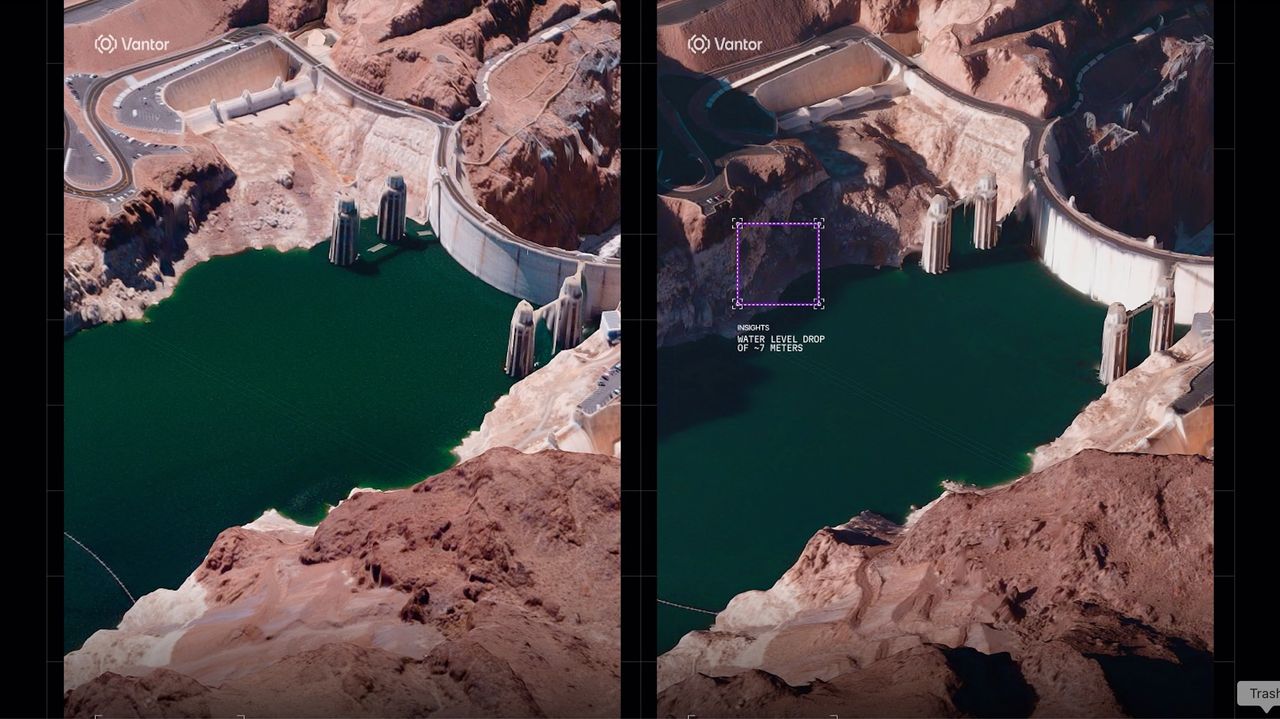
Vantor, an American Earth-observation company, has begun producing three-dimensional satellite imagery of Earth with unprecedented detail and clarity. The company's new mapping capability represents a shift in how satellite data captures and represents terrestrial features.
Traditional satellite imagery provides two-dimensional views of landscapes, cities, and infrastructure. Vantor's 3D approach adds vertical dimension to these observations, allowing users to see terrain elevation, building heights, and topographic variations in ways flat images cannot convey. This depth information comes from advanced processing of satellite data, likely using stereo imaging or synthetic aperture radar techniques to extract height information from orbital observations.
The applications span multiple sectors. Urban planners can assess development patterns and infrastructure with greater precision. Environmental scientists gain better tools for monitoring deforestation, coastal erosion, and land-use changes. Disaster response teams could use 3D maps to evaluate damage after earthquakes or floods. Agricultural analysts might track crop health and field conditions more accurately.
Vantor's technology builds on decades of Earth-observation satellite development. Companies like Planet Labs and Maxar Technologies have pushed resolution boundaries, while agencies like NASA and the European Space Agency have advanced processing methods. Vantor's contribution focuses on converting orbital data into truly three-dimensional representations rather than flat orthographic projections.
The company's "stunning" imagery quality suggests their processing pipeline successfully resolves both planimetric accuracy (horizontal positioning) and accurate height data simultaneously. This requires sophisticated algorithms to handle atmospheric effects, image registration, and quality control across large geographic areas.
Limitations remain. Cloud cover still blocks views of some regions. The exact resolution of Vantor's 3D products and their update frequency require clarification. Processing costs for global 3D mapping may restrict accessibility for smaller organizations and developing nations.
Nevertheless, the transition from 2D to 3D Earth observation marks tangible progress in remote sensing. As satellite con