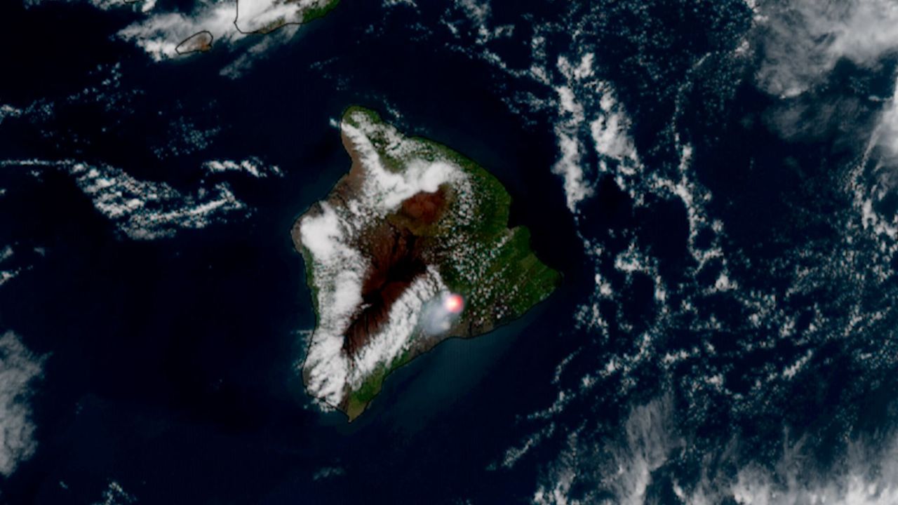
A volcanic eruption from Hawaii's Kīlauea volcano generated spectacular imagery when observed from Earth orbit on June 17, 2026. The eruption marked the 49th documented eruptive episode at this highly active volcano on the Big Island.
Kīlauea ranks among the world's most continuously active volcanoes. Its frequent eruptions make it an ideal natural laboratory for scientists studying volcanic processes and atmospheric effects. Space-based imagery captured the eruption's thermal signature and ash plume, revealing details about lava effusion rates and gas emissions that ground-based instruments alone cannot provide.
Satellite observations from platforms like NASA's Earth Observing System or NOAA's GOES satellites track volcanic eruptions in real time. These instruments measure infrared radiation emitted by hot lava, map ash dispersal patterns, and monitor sulfur dioxide emissions. Such data proves invaluable for air quality forecasting, aviation safety alerts, and understanding how volcanic activity influences regional and global atmospheric conditions.
Kīlauea's frequent eruptions stem from its location above a hotspot in Earth's mantle, where magma continuously rises to the surface. The volcano sits within Hawaii Volcanoes National Park, where the U.S. Geological Survey operates monitoring networks. Ground-based seismometers, GPS networks, and gas sensors provide complementary data to satellite observations, creating a comprehensive picture of subsurface magma movement and surface activity.
The 49th eruption illustrates Kīlauea's relentless geologic activity. Since 1983, the volcano has erupted nearly continuously, though eruptions vary dramatically in intensity, duration, and location. Some episodes produce slow-moving lava fountains; others generate explosive activity that sends ash kilometers into the atmosphere. Space imagery helps researchers track changes in eruptive style and predict future volcanic behavior.
Understanding