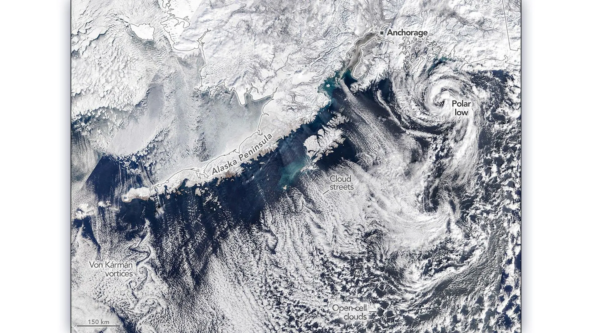
A NASA satellite captured a rare atmospheric phenomenon over southern Alaska as winter's final weeks delivered a spectacular display of cloud formations and a compact polar storm. Cold Arctic air masses flowing over warmer ocean waters generated long parallel cloud bands, swirling vortex patterns, and intense wind systems near the coast.
The dramatic scene unfolded as contrasting air temperatures collided. The frigid Arctic air began warming as it traveled across the relatively temperate Gulf of Alaska waters, creating instability in the atmosphere. This temperature gradient drove the formation of organized cloud structures that evolved into increasingly complex patterns as the system moved offshore.
Polar storms of this type remain relatively uncommon in satellite imagery. The compact, rotating storm system visible in the NASA imagery possessed powerful winds that reflected the intense energy released when cold air interacts with warmer ocean surfaces. These storms develop rapidly and dissipate just as quickly, making real-time satellite observation valuable for meteorologists studying extreme weather dynamics in high latitudes.
The cloud patterns demonstrated the atmosphere's sensitivity to local conditions. Linear cloud formations aligned with wind direction, while the swirling vortex structures indicated rotating air columns triggered by wind shear and thermal instability. Scientists use such observations to refine models predicting arctic weather behavior and understand how climate patterns influence polar meteorology.
Alaska's coastal regions experience these extreme temperature contrasts seasonally as Arctic outbreaks push southward across the continent. Late winter presents particularly dynamic conditions as the seasonal transition amplifies atmospheric instability. Satellite monitoring provides continuous documentation of these events, revealing structures invisible from ground-based instruments alone.
THE BOTTOM LINE: NASA's satellite imagery captured rare polar storm dynamics and cloud formations over Alaska, documenting atmospheric instability driven by colliding cold and warm air masses.